Delaware City, Delaware

May 19, 2019

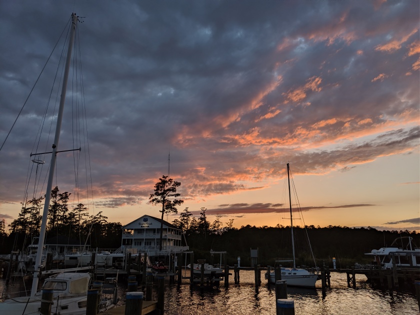
As planned, we were underway from Oxford Safe Harbor Marina by 08:00, and we headed north into another beautiful, sunny morning.  Winds were light, seas were calm and there was very little boat traffic on Chesapeake Bay as we exited the Choptank River.  Nice way to start the day.

For the most part the transit some 30 miles to the Bay Bridge by Annapolis, then 40 miles up to the 14 mile long C & D canal were uneventful, except that for the last 15 miles or so before the canal there was quite a bit of wood debris in the water.  It was mostly relatively small diameter tree branches, but there were occasional logs and Carol even saw a couple of sheets of plywood.  We “thumped” one something, which got our attention and we both kept a sharp lookout after that to avoid hitting something more substantial, which could cause a bent prop or other damage to the boat.  As I say, this went on for several miles, even slightly into the canal.  At one point a couple of miles after the first area of debris we passed a 110 foot US Coast Guard cutter headed the other way.  I radioed them to give them a heads-up about the wood in the water and they thanked me but said nothing to warn me that there was a lot more debris ahead for us.  Disappointing…

There was much more boat traffic in the Bay starting just before Annapolis, which is a huge sailing center.  We could see several sailboat races going on and I would go out of my way to not interfere with a race course, but in fact we didn’t have any problems with the races.  Once through the Bay Bridge the traffic slacked off a bit until we got near Rock Hall, and from there until we got through the canal there were sailboats, powerboats, and my personal favorite (not!) jet skis galore, out enjoying a beautiful spring Sunday.  Our boat makes a fairly large wake, which attracts young men on jet skis like moths to a flame because they like to jump the wake.  Some of them get surprisingly high in the air and I’m sure they love it, while the Captain hates having any vessel head toward us at high speed. The weather held all the way through the canal, and once past Chesapeake City the boat traffic slacked off significantly.

Our destination, Delaware City Marina, is on a very narrow canal with shoal mud flats at the entrance and swift currents.  When I phoned earlier this morning to make our reservation Tim, the owner, asked if I’ve ever been there before and when I said No, he told me to phone him again when we were under the last bridge in the Canal, which is a half mile or so before exiting the canal into Delaware River .  This I did, and Tim gave me detailed directions for the 2 miles from the C&D Canal to the Delaware City Branch Canal, where the marina is located, and said to radio him again when we were off the entrance.  Yikes!  I like to think I’m pretty good at following directions and of course I didn’t want to go aground, but I was surprised by the detail of his directions as he walked me in on the radio all the way to our dock.  The current was behind us and we were to moor starboard side to a long floating face dock, which can be tricky in a single-screw boat, but again Tim was right there on the dock and he talked me right alongside as pretty as you please.

My goal all day had been to be docked in time for the 17:00 briefing, and we made it with an hour to spare.  My friend Peter kind of warned me that Tim might make the trip down the Bay sound scarier than it probably is, and in fact he made dire predictions about both current and wave heights, which he said would almost certainly be twice whatever NOAA predicted near the mouth of the Bay.  The marine forecast  and tide predictions called for Southwest winds 10-15 knots and a rising tide for the next day, which I had thought sounded perfectly reasonable.  But Tim wasn’t so sure and he strongly suggested getting up for the 04:00 forecast update before deciding whether to go or wait.  Unfortunately or not, Carol came away from the briefing a bit shaken at the prospect of the doom & gloom Tim had suggested.

But as a good follower of directions I dutifully woke up at 04:00 and checked the forecast, which was pretty much as it was the day before except they added, “…seas 3-4 feet later in the morning.”  Well, if we left at 06:00, as we would in order to have a favorable tidal current, we would get to the entrance of the Bay late morning.  And since Tim had assured us that the seas would be twice whatever was forecast, that would mean we would find 6-8 foot short period seas at the mouth, which would be fairly nasty and I knew Carol would hate (I wouldn’t like it, either!).  I considered downplaying the forecast to Carol and going ahead because I kind of thought Tim was exaggerating, but then I reconsidered because my credibility would be in jeopardy if I told Carol everything would be OK and we ran into 8’ seas.

So I went back to bed and we’re here until at least Wednesday, because the forecast for tomorrow is for much higher winds as a front comes through.  There’s not much going on in Delaware City except for a few shops and Crabby Dick’s crab house, but the marina is very protected and the docks are substantial, if the heads and showers are a OK but kind of old, and there are definitely worse places to be stuck for 3 days.  There are 2 or 3 Loopers here and I’m sure we’ll be fine.

BTW, later on Monday afternoon I posted on a Facebook group I’ve been participating in.  I

asked if anyone had gone down Delaware Bay that day and asked what the conditions were like.  As I suspected, several boats responded and said it had  been a lovely day with calm conditions.  Maybe I should have trusted my instincts.

Today:  93.0 nautical miles

Running total: 928.7 nautical miles


Oxford, Maryland

May 18, 2019

The plan to spend a week cruising Chesapeake Bay has been revised due to the marine weather forecast for the next week.  We’ve gotten a bit spoiled, weather-wise, having been in protected, inland waters for the past couple of weeks where we’ve been mainly concerned with sun versus rain.  Once we get into Delaware Bay we’re going to have to be much more aware of wind and sea conditions for the rest of the trip home.  First there’s the 50 mile trip down that bay, then a 100+ mile ocean passage along the New Jersey coast to New York, then 175 or so miles through Long Island, Rhode Island, Block Island, Vineyard and Nantucket Sounds.  I’m trying to apply the lessons we learned last fall when it took us over a week longer than planned just to get to New York, due to difficult weather.  We have family commitments at home starting at the beginning of June, so we have to push it a bit now to get close to home waters within the next week, to allow for some slack days in case we’re held up by weather again.  The plan now is to go from here directly to Delaware City, half-way up Delaware Bay, to position ourselves to take advantage of a favorable weather window to get down the Bay.

Anyway, today we had a short 32 mile trip across Chesapeake Bay to Oxford, a small, upscale summer community on the Eastern shore of Maryland.  Oxford, St. Michaels and Cambridge are close to one another and we more or less randomly chose Oxford to experience the Eastern shore.  It was a perfect day on the water: in the high 70’s F, very little wind and calm seas.  And when we came around the headland into Oxford harbor the temperature jumped up around 10 degrees and we found a beautiful little yachting village on a perfectly clear & sunny day.  The village is quite small, population-wise yet there are 5 marinas, all largely full of boats.  Ours was the first marina on arrival in the harbor, and we quickly moored to the fixed dock, got the boat settled in and immediately put up the awning, then I decided to walk the half-mile to what the dock guy told us was the best ice cream we’ll ever find.  Hmmm, says I, that’s a claim worth investigating!  It was a nice walk through the quite little village, and the ice cream was very good.  The best I’ll ever find?  Not so sure about that…

We chilled on the boat for most of the rest of the afternoon as it was actually pretty hot, even under the awning out of the sun.  But then we remembered that the marina has a swimming pool, which turned out to be just what the doctor ordered.  We walked over to the pool, set up a sun awning, and I dropped into the cool-but-not-cold water.  Ahhh – if only I’d thought to bring a margarita with me!

If Oxford has one drawback it’s that there are only 3 or 4 restaurants and Google Maps says they’re all over a mile from the harbor, and there is virtually no transportation available before Memorial Day.  The nearest taxis and Uber are in Easton, over 10 miles away.  We asked the dock staff for advice and the consensus was that a taxi would be too expensive because they’d charge us for the trips to & from Easton in addition to the fare to the restaurant, and we’d still have to get back to the boat after dinner.  We checked Uber and the app said, “No cars available.”  But then Jeff, the marina manager, said he was about to head home and would drop us at Dock’s Sunset Grille, and we figured a mile walk back to the marina wouldn’t be unreasonable.  But of course half way there we realized that what Google Maps said was 1 mile was really closer to 3, so suddenly the walk home sounded less reasonable.  But we continued on to Doc’s, where the dinner and the sunset were very good (if the service was terrible), and when we checked Uber again after dinner there was 1 car available to save the day, so that’s how we got home to the boat.  All in all it was a nice day and evening.

The guy who runs the marina in Delaware City gives a weather & advice briefing every evening at 17:00, geared toward transiting down Delaware Bay (or not, depending on conditions).  I definitely wanted to be there for the briefing and it’s some 95 miles to Delaware City, so we planned for an 08:00 departure from Oxford.

Today:  32.4 nautical miles

Running total: 835.7 nautical miles

Solomons, Maryland

May 17, 2019

The plan is to spend several days in Chesapeake Bay, working our way north to the C&D Canal and across to Delaware Bay.  The problem is that we only have a few days to cruise Chesapeake Bay and there are so many nice harbors that deserve a visit, but we just don’t have time for many stops.  And when we do stop each place is so nice that I’m inclined to spend at least another day there…but again, we don’t have the time.  So obviously we’ll have to come back some day and spend some more serious cruising time.

In the meantime, today we went from Yorktown to Solomons, a harbor we visited on the way down last fall and that we both liked enough to make a repeat visit.  The trip up from Yorktown was interesting in that it was different being in open water again after spending so much time in rivers, marshes and canals.  We passed quite a bit of shipping, both underway and anchored, and several lighthouses.  The lighthouses here are different than most in New England, often being out in open water rather than on an island or a point of land.  Even though we both would like to see more of the Bay, we chose Solomons in part because there simply aren’t many or any deep water harbors on the Eastern Shore in the southern part of the Bay.  The northern half has lots of deep water harbors on both sides, but anyway we decided to pass some viable candidates and keep going to Solomons.  Reedville, Washington, DC, and others will just have to wait until we return.

We stayed at the same marina in Solomons, Safe Harbor Zahnisers.  We pulled in mid-afternoon, we both took showers ashore, then we just chilled until Happy Hour at the dockside restaurant at 18:00.  The marina has a pool and some other amenities, but we chose to just relax.  Solomons is a really busy boating harbor, with power and sail boats constantly coming and going, both recreational and commercial (mainly crabbers).  Zahnisers appears to be primarily a sailboat marina, while across the harbor at Calvert’s there are mostly power boats.

Several of the marinas have dockside bars & restaurants.  We were there on a Friday night, and one marina in particular had a very loud band playing on the dock until 23:00.  We certainly don’t begrudge the young people their parties and loud music, but at the same time we were glad when it suddenly got quite across the harbor.  There was a beautiful nearly-full moon tonight and the wind had died to flat calm, and the sudden quiet when the band stopped was the icing on the cake of a beautiful night at Somonons harbor.

Today:  86.6 nautical miles

Running total: 803.3 nautical miles

Yorktown, Virginia

Yorktown, VA

May 16, 2019

I think we were both ready for a short day, so we left at 10:40 and just went a short way north in Chesapeake Bay to Yorktown.  It a nice little town a few miles up the York River, where they’ve carefully maintained the town’s 1700’s character.  Because this, after all, is where the Revolutionary War ended when George Washington finally defeated Lord Cornwallis and effectively ended the war and kicked those nasty Brits out (sorry Grant and Kevin!).  The battlefield has been preserved as a national historical monument, although we didn’t do any of the historical stuff on this trip.  I cumulatively spent over a year in Yorktown at the Coast Guard Training Center there attending various training schools, including Officer Candidate School in 1980 & 81, just before Carol and I got married.  We lived just a few miles down the road in Hampton for 4 years and visited Yorktown then, and other than the waterfront, it hasn’t changed much at all.  I walked around a bit, but we were too late to visit the Revolutionary War museum and not much else interested us much, so we just hung around on the waterfront.

We docked at Riverwalk Landing Marina for the night, which is a City marina, is new since we lived there, and is pretty nice.  It’s early in the boating season here and there were only 4 other boats in the marina – all northbounders on the ICW, so it was a nice, quiet night.  We grilled in the cockpit and had an early night.

Today:  28.9 nautical miles

Running total: 716.7 nautical miles


Hampton, Virginia

May 15, 2019

Today marked another state line crossing, as we passed from North Carolina into Virginia.  The day started early, though, as we and several other boats left Coinjock between 05:00 and 05:30.  The reason was that the Army Corps of Engineers had announced that the North Landing Bridge, some 35 miles farther along, which opens on the hour and half-hour, would be shut down for 48 hours after the 09:30 opening today, for some major repairs.  There had been rumors about this up & down the ICW for the past several days.  I phoned the ACOE on arrival at Coinjock to get the real story, and we immediately planned to get underway no later than 05:30.  Anyone who missed the 09:30 opening was going to be in a pickle, because there are only 2 or 3 marinas between Coinjock and the bridge, and if you got as far as the bridge and couldn’t get through you could pretty much bet that everything behind you was full with new northbounders.  So there was quite an exodus during those early hours on Wednesday and the ICW got pretty crowded with people who were bound and determined to make it to the bridge before 09:30.

We are faster than some and slower than others, but in any event we made the 08:30 opening and had no problems.  We monitored some other boats on AIS who we’d gotten friendly with at Belhaven and/or Coinjock, and we’re pretty sure everyone who wanted to, got through.  One couple we met in Belhaven, who live on an Island Packet 40, stayed in Belhaven for a few more days due to the rumors about the bridge., figuring they’d wait for the crush of boats to get through.  Some people are lucky and have no real schedule.  Must be nice…

So shortly after the North Landing Bridge are the Great Bridge bridge and the Great Bridge lock, where there was still a bit of a crowd from the Coinjock exodus.  The lock was full and we were the last ones to get in, but all’s well that ends well.  The difficult thing for the ACOE in closing the ICW for several days is the effects on commercial traffic.  For recreational boaters getting stuck for 48 hours in an inconvenience; for commercial vessels it means losing real money.  You don’t see many tugs & barges in the deep southern sections of the ICW, but between Coinjock and Norfolk we passed several and one wonders what they will do with the waterway closed.  Well, what they’ll do is obvious: wait until it opens again, but there are construction projects that are waiting for sand & gravel, pilings, etc., and none of that was going to move until at least Friday.

Norfolk is always an interesting place to pass through, because right where the Dismal Swamp Canal branch of the ICW merges back into the main ICW, both sides of the waterway become heavily industrial.  There are cement plants, contractor yards with huge barges & cranes, all manner of oil, chemical and gas facilities, there’s a huge and diverse U.S. Navy presence, with shipyards as well as operational bases, not to mention several commercial shipyards.  And that’s all before you get to the downtown cities of Norfolk and Portsmouth, where there are more shipyards, container facilities and marinas.  You fairly suddenly pass from marshes, forests and nothing but recreational boats, into a very industrial world, and it rather catches one off-guard.  Yikes – the real world!

I found it bittersweet to once again pass the Mile Zero buoy in Portsmouth and realize that this trip that I’d dreamed about for so long was nearing its end.  Not that we’ll never get back this way again on our boat, but the lackadaisical meander down the ICW to Florida was over, and the reality of getting back to “the real world” was staring me in the face.  Of course, getting home also means getting back to family and loved-ones, and of course that’s a good thing.  It’s just that I may like boating a bit too much (is there such a thing?!?).

The flip side of an early departure is often an early arrival at your destination, and such was the case today when we pulled into our slip at the Hampton Public Piers marina, which is right in the middle of downtown Hampton, at noon.  Carol and I have both been looking forward to getting to Hampton, where we lived for 4 years in the early 80’s when I was stationed in Norfolk.  Hampton was our first married home and we were anxious to see what it’s like now.  We lived in a nice neighborhood a few miles from the harbor, but “downtown” Hampton, near the harbor, was something of a dump in those days, with a lot of vacant buildings – it was a place you avoided at night.  As we’d read, that’s all changed now and everything is new and the beneficiary of urban renewal.  There are new buildings everywhere with nice new houses and apartments on tree-lined streets.  One block behind the main drag is a street full of bars, restaurants and antique shops – really nice.  I’m sure downtown Hampton is a nice place to live now, and we saw lots of people from a variety of backgrounds who appeared to live there.  It looks like they’ve done a really nice job of bringing Hampton back to life.

After a nice dinner at one of those little restaurants, we had a fairly early to-bed after what was, after all, a long but nice day.

Today:  54.5 nautical miles

Running total: 687.8 nautical miles


Coinjock, North Carolina

May 14, 2019

We finally got underway from Belhaven today.  We and several other boats from our marina got an early start by 06:10 and it was a beautiful morning, with virtually no wind and flat calm conditions as we continued up the ICW.

Our route today took us up the rest of the Pungo River to 20 miles in the Pungo River/Alligator River Canal to (not surprisingly) the Alligator River, then 18 miles up to Albermarle Sound and across into a series of small creeks and rivers to Coinjock.  Albemarle Sound is somewhat notorious for being quite rough, for such a relatively small body of water, as it’s about 40 miles long and 12 miles wide in an East/West configuration but less than 20 feet deep, so especially with an East or West wind of any strength it can really kick up into short, steep waves that can be quite uncomfortable.  The weather systems across the country have been rather unsettled for the past few days and the marine forecasts for Albemarle Sound have been less than inviting, which is why several of our marina mates have been sitting it out, waiting for favorable conditions.  Well, today was the day and we hardly saw a ripple on the water as several of us took advantage of the forecast for light winds and calm seas, and today the forecast proved to be spot on.  It rained on & off, but we virtually glided across the Sound and up to Coinjock.

The one big negative today was that our troublesome alternator appeared to be acting up again.  The voltage gauge was erratic: normal at 14 volts one minute, then pegged at 16.5, then back to normal, then 15, etc.  I first noticed it in the upper Alligator River and we briefly considered turning back to Belhaven, both to minimize potential damage to the batteries and to seek “warranty work” from Axsom and company.  But I figured we were about half way to Coinjock already, which is near Norfolk, Virginia, which is a major seaport where we would certainly have better access to not only experienced technicians, but any parts that might be required.  So once again I phoned ahead to our destination marina and scheduled attendance by an electrician on arrival.  He was there as promised, and found that some critical cables were only hand-tight, likely causing the erratic readings on the volt meter.  He tightened everything up and “promised” that everything would be cool when we got going.  We’ll see…  The good news, other than the problem is hopefully fixed, is that Brian figured out that some of the problem is likely the gauge itself, and when it pegs at the high end all you have to do is knock on it and it goes back down to 14 volts.  That still leaves the question as to why it goes up high in the first place, but at least now we can make it go down again.

Coinjock is just a long face dock along the ICW in the middle of nowhere, and they tie up the boats about 2 feet apart in order to fit the maximum number of boats in.  We were definitely one of the smallest boats there, but we saw a few boats we recognized from Belhaven, which was fun.  the boat directly behind us was a Kadey Krogen 50 from Warwick,, Rhode Island that was at Belhaven yesterday.  Really nice folks who we will definitely look up of we make it back to Wickford this summer, which we hope to do.

The restaurant there is renowned for their 32 oz. prime rib, but neither Carol nor I are big red meat eaters (and who can eat 32 ounces of beef, anyway?!?) so we passed and had fish and chicken.  But the restaurant is surprisingly good with a diverse menu, and we both had good dinners.

Tomorrow the plan is to pass through Norfolk, past “Mile Zero” once again as we exit the ICW, then across Hampton Roads to Hampton, where we lived for 4 years when I was stationed in Norfolk in the early 80’s.  We’ve read that Hampton has undergone quite a bit of urban renewal and that the waterfront, which was really rundown when we lived there, is now very cool, with upscale shops, bars and restaurants, and microbreweries.  We’re anxious to see it, and personally I’m even more anxious to see if Brian really fixed our electrical problem!

Today:  72.5 nautical miles

Running total: 633.3 nautical miles

Belhaven, North Carolina

May 10, 2019

We weighed anchor shortly after 08:00, motored out of Mile Hammock Bay and headed north on the ICW on another beautiful, calm, blue sky morning.  The plan for today was to go as far as Oriental, North Carolina, but it was early when we got near Oriental so we decided to keep going to Belhaven.  The whole morning the weather was just about perfect: sunny, blue skies, temperature around mid-70’s F, and light winds.  There was a ton of boat and commercial traffic as we passed through Morehead City, but from there the ICW turns north into rural residential areas and we pretty much had the waterway to ourselves.  It was a really nice several hours, and we arrived at Dowry Creek Marina at 16:30.

The previous afternoon I had noticed that the voltage gauge on the bridge was pegged at 16.5 volts, and it should have been closer to 13.5.  I was concerned but decided to keep an eye on it and see if it corrected itself, which it didn’t.  When we started this morning it was right on the mark so I wasn’t worried…until around noon when I saw that it was pegged at 16.5 again.  It could have been a faulty voltage gauge, but if the alternator really was putting out 16.5 volts it could result in “cooking” (i.e., destroying) the batteries, which would both be very expensive and could cause other damage.  I phoned the electrician back home on Cape Cod who did some work on the boat last summer and described the problem to him, and he said it was probably the alternator and I should definitely not continue until I got it looked at.  So I phoned ahead to Dowry Creek Marina and asked them to try to arrange for an electrician to attend the boat and diagnose the problem.  I knew we wouldn’t get to the marina until after 16:00 so I wasn’t overly optimistic that an electrician would be available right then, and of course for all I knew there might not be an available electrician for a couple of days due to prior commitments.  Belhaven, after all, is very much off the beaten path and I had no idea how much of a technical infrastructure there might be locally.  But when we arrived at the marina I got a text from an electrician who said he’d be down first thing in the morning to see what the problem might be.

Axsom (Yes – that’s his name) showed up the next morning, measured the output of the alternator with his meter and declared it to be the problem.  There are no markings on the alternator to indicate the make or model, so after Axsom removed it from the engine he sent me to Washington, NC (40 miles away) to a parts store that he said would be the most likely to be able to identify it and  locate a new one.  Of course it was 10:30 on Saturday morning and the store closed at noon, so Carol and I got into one of the marina’s courtesy cars and dashed up to Washington.  We got there in time and the guys in the store dug through their inventory and numerous catalogs, and finally said there wasn’t one available locally but they could order one from Ohio or they could take mine to a local guy who rebuilds such things and who could almost certainly have it back to me by lunchtime on Monday.  I chose the latter due to both cost and time.

Flash ahead to Monday (yes – we were still there on Monday) and I drove back to Washington, where I picked up my rebuilt alternator for Axsom to reinstall later that evening.  The good news was twofold: the rebuilt alternator seemed to work, and the 8D AGM batteries weren’t damaged.

Dowry Creek isn’t an expensive marina, and with some dodgy weather forecast for the weekend and the next couple of days there were several boats holed up here, and we got friendly with a couple of other couples, and that somewhat lessened the frustration of being delayed for 3 days.  Plus the marina had been really helpful and supportive – they have 3 courtesy cars that we’ve used to go out to dinner a couple of times, to go food shopping and to drive to the parts store for the alternator repair.  The showers and heads here were nice and the laundry machines were free, so we definitely could have had a worse place to be stuck with mechanical problems.  Still, it will be good to get back on our way tomorrow.

Today:  99.2 nautical miles

Running total: 560.8 nautical miles

IMG_20190513_195952IMG_20190513_195139

Mile Hammock Bay, North Carolina

May 9, 2019

We again got a late start today because I had a diver come and clean the bottom of the boat.  Ever since leaving St. Augustine I’ve noticed that the boat has been going between 1 & 2 knots slower at a given RPM than she used to, plus I’ve felt a small vibration at higher RPMs that wasn’t there before.  I suspected barnacles on the prop for the vibration and barnacles & other marine growth on the bottom for the drop in speed, which also means increased fuel consumption.  So I had called ahead to Southport Marina for a referral to a diver, and we were all set up for him to attend the boat 1st thing on Thursday morning.

I was ready for the diver by 07:00 but of course first thing turned into 09:45 because he was working on another job in the marina before he came to us.  I explained what I suspected he’d find, and he quite rightly replied, “We’ll see – I’ll let you know in a bit.”  He was in the water for almost an hour and we could hear him scraping away, but when he came up he said the bottom actually looked pretty clean.  The prop, rudder and trim tabs (the only metal parts below the waterline) were spotless, but there were scattered barnacles all over the bottom which cumulatively would slow the boat down a little and increase drag through the water.  Most importantly, he found that the sacrificial zincs on the trim tabs were about 90% gone, which is normal for a boat that’s been in the water for over a year (the zincs were replaced when the boat was hauled for the winter in 2017).  In any event I had him replace them, because once the zincs are gone (a natural process of galvanic action) the trim tabs would have basically become sacrificial.  Not good!

So the diver wrapped up his work and off we went at 11:35.  It was a glorious morning and a real pleasure to be out on the water.  We had hoped to go up the ICW about 30 miles to Masonboro Inlet, then jump outside for a 75 mile ocean run to Beaufort.  The conditions were almost perfect for that plan (East winds at 5-10 kts) in the morning but were forecast to increase in the afternoon, plus the tide would be ebbing in the afternoon which would have meant wind against tide in the inlet, almost always resulting in choppy, sloppy conditions.  So we had decided that we’d go outside if we could be in the inlet by 13:00, otherwise we’d stay in the ICW and see how far we could get.  So with the 11:35 departure we missed our window, which was somewhat disappointing because I love open ocean passages, but on the other hand it was yet another beautiful, light wind day in the ICW so we had nothing to complain about.

It was an interesting day navigation-wise in that we had to negotiate several opening bridges, which sometimes means timing it right because some bridges open “on demand” while others only open on the hour and half-hour.  We managed to arrive at the Wrightsville Beach drawbridge at 13:20, and it only opens on the hour.  There’s a pretty wicked current right there so the prospect of milling around for 40 minutes wasn’t appealing, and there are marinas on both sides of the channel for a mile or so, so anchoring wasn’t an option.  The posted vertical clearance on the bridge is 16 feet, and our air draft (height above the water) is about 13 feet with the VHF antenna down (19 feet with it up) so technically we could lower the antenna and proceed.  But the posted clearances under these bridges are notoriously inaccurate, so I wasn’t entirely confident that we could make it, and a miscalculation would result in ripping our radar antenna off…not an enticing prospect!  I tried radioing TowboatUS and SeaTow, both of which had boats based right by the bridge, to ask what they think the actual clearance is, but neither of them answered.  So I asked the bridge tender and she assured me it was 16 feet at the current state of the tide.  So I lowered the antenna we crept slowly up to the middle of the span and just before the radar antenna got there the bridge tender radioed me, “Captain, you have plenty of room.”  So the long and short of it is that we slid right under, pretty as you please, and continued on our merry way.

Our fallback plan if we didn’t make the inlet in time was to anchor in Mile Hammock Bay, which is a little square bay cut out of the marsh in the middle of U.S. Marine Corps base Camp Lejeune, that can hold 20 or so boats.  It’s open to the public for anchoring, fishing or whatever (as long as there are no ongoing live-fire exercises!), but the public is absolutely prohibited from going ashore for any reason.  Mile Hammock has a reputation for a soft, mucky mud bottom and dragging anchor is a real problem if the wind kicks up, but the forecast was for light winds all night so that was our destination.  We got there at 16:30 and found 3 boats already anchored: 2 power boats and a Catalina 36.  I first tried anchoring close to the eastern side of the bay, upwind of the sailboat, but true to its reputation we couldn’t get the anchor to set.  We could tell we were in some very soupy stuff so Carol brought the anchor back up and I moved downwind a bit to where we were between 2 of the other boats, and the anchor set fine there.  3 other boats came in and anchored later in the evening, but there was plenty of room so no problem for us.

It was a beautiful setting, totally quiet and peaceful…except for 4 Marine Corps landing craft that were moored to the wharf at the head of the bay, all of which had their engines on and rumbling away for the first 45 minutes or so we were there.  There were about 30 Marines formed up on the wharf, who eventually deployed to the 4 craft, and 1 by 1 they left the bay.  Nice folks – they waved to everyone as they passed our boats.  And once they left it truly was quiet and peaceful.  After cocktails I cooked dinner on the grill in the cockpit, and we had a beautiful night.

Today: 55.9 nautical miles

Running total: 461.6 nautical miles

Southport, North Carolina

May 8, 2019

We left Osprey Marina pretty early and had a lovely, peaceful morning along the ICW.  The river is narrower here than yesterday and the woods come right to the water’s edge, and the homes are surprisingly low and close to the water level, too.  There was almost no other boat traffic for the first couple of hours, and Carol cooked breakfast and served us on the bridge as we meandered along.  Very nice.

Then we passed through Myrtle Beach proper, which is kind of interesting.  The houses in this section are all new and big – we got the impression that everyone is trying to make sure everyone will be impressed with their imposing abode.  This includes really fancy stone work in the very elaborate retaining walls for the patios, swimming pools, hot tubs, etc., because the houses on one side of the waterway are mostly on a hill that’s quite high and slopes steeply down to the water.  Some folks just leave the hill and plant grass, but most terrace it with these walls and other structures.  It’s nice, I guess, but seemed rather presumptuous to us.

After Myrtle Beach we passed through New River, which is a working waterfront town with shrimp boats, crabbers and even casino boats.  It’s a busy section of the waterway and the “idle speed, no wake” rule is rigidly enforced.  But in its own way it’s a relief after Myrtle Beach.  Pretty much every day we spot a bizarre or just garish house along the way.  Sometimes it’s just the fact that it’s purple or bright pink, and sometimes it’s the design of the house itself.  They do make things interesting for passers-by, though.

Happily, the inlets into the ocean from the ICW for the next 30 or so miles have all been dredged this past winter, so New River Inlet, Lockwoods Folly and a couple of others that for years have had reputations for unpredictable shoaling are now a piece of cake and you can pass straight through.  In the past fellow boaters shared zigzag routes through these areas to try to avoid going aground, but no more.  Whew!

Other than that today was uneventful, which is often a good thing.  We pulled in to Southport Marina, where we stayed last fall on our way south, fairly early, around 14:00, because Southport is probably our favorite town along the ICW and we wanted to have time to walk around and do some more exploring.  Southport took a beating last year in the hurricanes, but that’s nothing new for these low-lying places along the coast.  There are many houses that were built in the 1800’s (which is considered old in the U.S.), and they’re beautifully maintained.  We came across one man who was working in his yard whose house was built in 1889, and he told us all about his and his neighbors’ houses, when they were built and when they were remodeled, etc.  He was obviously quite proud of his house and his town and was happy to tell us all about it.

Eventually we found our way to a little harbor side restaurant for drinks and dinner, then were back in the marina for the nightly 18:00 ICW briefing.  I may have mentioned doing this last fall: a retired meteorologist who lives on his boat in the marina gives a 90 minute detailed briefing on conditions in the ICW every night. In the fall he covers southbound from Southport to Savannah, and in the spring he covers northbound from Southport to Norfolk, and it’s underwritten by the marina and some local marine merchants.  He provides a fairly bulky packet of color handouts with blowups of any problem areas, including where the good water is (i.e., “from green #91 to red #104 favor the green side of the channel, etc. due to recent reports of shoaling,” or be aware that red buoy #34 is reported missing – stay on the green side in this area”, etc.).  there were about a dozen people there for the briefing tonight, and our navigator was glad she/we went.

Today: 56.0 nautical miles

Running total: 405.7 nautical miles

Myrtle Beach, South Carolina

IMG-20190509-WA0001May 7, 2019

I wouldn’t have minded staying in Charleston for another day, but we wanted to keep moving so we have enough time to stop in places we haven’t been before.  So off we went at 08:05, inside today up the ICW.

For the first time in many years, there has been a lot of dredging in the ICW this winter, and I knew we would be running into several dredges along the way today.  Our marina was on the west side of the peninsula where Charleston is located, so we looped around the city, across the south channel and back into the ICW at Sullivan Island.  This isn’t a particularly scenic part of the trip, although it’s interesting to see the variety of homes along the way.  Everyone has a dock, and for the first several miles the houses are close to the shoreline and the water is fairly deep close to shore, so the docks are short.  But first the houses are really large, then maybe a little, old camp-like house or 2, then a couple more big ones, etc…  Most likely this area started out as off-beaten-path where blue collar families could afford to live, then bridges were built and more affluent people could more easily get to work in Charleston so the small houses started getting replaced by bigger ones.  There are still plenty of rather rundown little houses right next door to huge 3 story palaces, which I guess made for interesting sightseeing and speculating for us.

We ran into our first dredge just before the Ben Sawyer Bridge, only a mile and a half into the ICW.  Dredges by their nature are working to deepen the channel, and often they are blocking most of it for passing traffic.  This was a pretty big unit with support work boats, tugs, barges and lots of pipe to take the dredge spoils ashore, but the channel is pretty wide there and most of the northbound channel was clear, so we slowed way down but passed smoothly and proceeded on our way.  Then there were several miles of open marsh before we crossed the Santee River, where wooded areas narrowed the marshes to 50 yards or so, which made somewhat more interesting scenery.  We passed quite a few other northbouners today including Loon, a 31 foot sailboat from Connecticut we rafted to in Vero Beach in January, whose Captain is 81 years old and lives aboard and sails alone, up and down the ICW every season.  What an inspiration!  She’s a really pretty little double-ender and it was fun to see Bill again as we passed him by.

Today’s route kept our navigator busy as she tried to follow the guidebooks, charts and guidance we’d received on our way south last fall.  The difficulty for Carol is that guide books et al are written with a southbound orientation, so she has to work backwards and try to keep track of where we are and what to expect next.  She did her usual stellar job, though, and we had an event-free day navigation-wise.  Probably the area of most concern today was 3 miles or so leading up to Mcclellanville, SC.  This is where we were warned last fall that if we got there at low tide, don’t even try to get through, even with our meager 3’ 10” draft, because the ICW along there has experienced significant shoaling for several years and hasn’t been dredged for quite some time.  Last fall we took Hank’s advice and stopped at the old Leland Oil Company dock rather than try to get through at low tide, but this time we got there at about half-tide on a rising tide, so I slowed down, we watched the depth sounder closely, and we kept going and got through with no problems.

Shortly after Mcclellanville we entered the Waccamaw River for 30 miles up to Bucksport, then Myrtle Beach, South Carolina and Osprey Marina.  This may be the most beautiful stretch of the ICW, from our perspective.  The river is plenty wide and it curves gently north with mile after mile of forest that comes right down to the water, with only occasional communities and marinas.  there was eve  one place with a Flemming at their dock!  We passed through there last fall, of course, but it was overcast and drizzling that day, and today it was brilliant blue sky all day, which highlighted the beautiful trees and small marshes that we passed, and we both kept commenting on how lovely it was.  The scenery was wonderful, the navigation deep and easy, and it was just a fantastic way to end the day.

We’d stayed at Osprey Marina before, which is well known as the cheapest marina along the route, with the lowest diesel prices .  We fueled up on arrival ($2.69/gallon), got the holding tank pumped out (free), then pulled in to our $1/foot slip.  This is a very nice marina – not fancy, but modern, well kept facilities – and everyone wonders why the prices are so low.  The dock guy who took our lines said it belongs to a wealthy contractor who operates the marina like a hobby project and doesn’t care about making much money with it, but whatever the reason the floating docks are great, the showers and heads are clean and nice, and the staff is great.  We probably could have gone farther today, but we like Osprey and anyway Carol had some paperwork she had to take care of and the gal at the desk is a Notary, so we were happy to stop and take care of things.

So once we got the boat squared away and Carol’s project completed, it was margarita time and we chilled in the cockpit till dinnertime, then I cooked pork chops on the grill and we had a great end to a great day.  Ahh….

Today: 83.2 nautical miles

Running total: 349.7 nautical miles


Design a site like this with WordPress.com
Get started